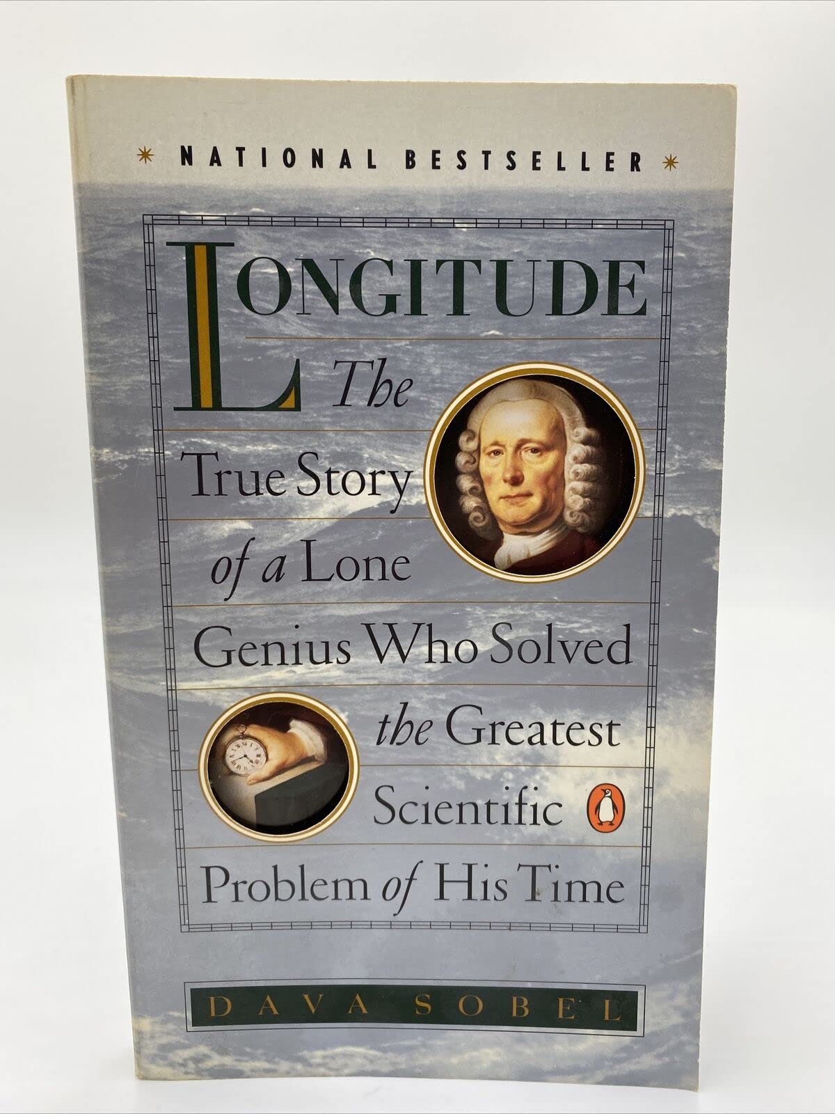
Longitude: The True Story of a Lone Genius Who Solved the Greatest Scientific Problem of His Time
$9.57
| Brand | Dava Sobel |
| Merchant | Amazon |
| Category | Books |
| Availability | In Stock Scarce |
| SKU | 0140258795 |
| Age Group | ADULT |
| Condition | NEW |
| Gender | UNISEX |
| Google Product Category | Media > Books |
| Product Type | Books > Subjects > Biographies & Memoirs > Professionals & Academics > Scientists |
About this item
Longitude: The True Story of a Lone Genius Who Solved the Greatest Scientific Problem of His Time
An award-winning science journalist traces the development of the marine chronometer by an obscure, uneducated clock maker--an invention that revolutionized sailing by allowing navigators to determine their ship's longitude. Reprint. Tour. Dava Sobel is an award-winning former science reporter for the New York Times , whose work has appeared in Audubon , Discover , Life , and the New Yorker . She lives in East Hampton, New York. Longitude The True Story of a Lone Genius Who Solved the Greatest Scientific Problem of His Time By Dava Sobel Penguin Books Copyright © 1996 Dava Sobel All right reserved. ISBN: 0140258795 CHAPTER ONE Imaginary Lines When I'm playful I use the meridians of longitude and parallels of latitude for a seine, and drag the Atlantic Ocean for whales. --MARK TWAIN, Life on the Mississippi : : Once on a Wednesday excursion when Iwas a little girl, my father bought me abeaded wire ball that I loved. At atouch, I could collapse the toy into a flatcoil between my palms, or pop it open to make a hollowsphere. Rounded out, it resembled a tiny Earth,because its hinged wires traced the same pattern ofintersecting circles that I had seen on the globe in myschoolroom--the thin black lines of latitude and longitude.The few colored beads slid along the wirepaths haphazardly, like ships on the high seas. My father strode up Fifth Avenue to RockefellerCenter with me on his shoulders, and we stopped tostare at the statue of Atlas, carrying Heaven and Earthon his. The bronze orb that Atlas held aloft, like the wiretoy in my hands, was a see-through world, defined byimaginary lines. The Equator. The Ecliptic. The Tropicof Cancer. The Tropic of Capricorn. The Arctic Circle.The prime meridian. Even then I could recognize,in the graph-paper grid imposed on the globe, a powerfulsymbol of all the real lands and waters on theplanet. Today, the latitude and longitude lines governwith more authority than I could have imagined forty-oddyears ago, for they stay fixed as the world changesits configuration underneath them--with continentsadrift across a widening sea, and national boundariesrepeatedly redrawn by war or peace. As a child, I learned the trick for remembering thedifference between latitude and longitude. The latitudelines, the parallels, really do stay parallel to eachother as they girdle the globe from the Equator to thepoles in a series of shrinking concentric rings. The meridiansof longitude go the other way: They loop fromthe North Pole to the South and back again in greatcircles of the same size, so they all converge at theends of the Earth. Lines of latitude and longitude began crisscrossingour worldview in ancient times, at least three centuriesbefore the birth of Christ. By A.D. 150, the cartographerand astronomer Ptolemy had plotted them onthe twenty-seven maps of his first world atlas. Alsofor this landmark volume, Ptolemy listed all the placenames in an index, in alphabetical order, with the latitudeand longitude of each--as well as he could gaugethem from travelers' reports. Ptolemy himself hadonly an armchair appreciation of the wider world. Acommon misconception of his day held that anyoneliving below the Equator would melt into deformityfrom the horrible heat. The Equator marked the zero-degree parallel oflatitude for Ptolemy. He did not choose it arbitrarilybut took it on higher authority from his predecessors,who had derived it from nature while observing themotions of the heavenly bodies. The sun, moon, andplanets pass almost directly overhead at the Equator.Likewise the Tropic of Cancer and the Tropic of Capricorn,two other famous parallels' assume their positionsat the sun's command. They mark the northernand southern boundaries of the sun's apparent motionover the course of the year. Ptolemy was free, however, to lay his prime meridian,the zero-degree longitude line, wherever heliked. He chose to run it through the Fortunate Islands(now called the Canary & Madeira Islands) off thenorthwest coast of Africa. Later mapmakers movedthe prime meridian to the Azores and to the CapeVerde Islands, as well as to Rome, Copenhagen, Jerusalem,St. Petersburg, Pisa, Paris, and Philadelphia,among other places, before it settled down at last inLondon. As the world turns, any line drawn from poleto pole may serve as well as any other for a startingline of reference. The placement of the prime meridianis a purely political decision. Here lies the real, hard-core difference betweenlatitude and longitude--beyond the superficial differencein line direction that any child can see: The zero-degreeparallel of latitude is fixed by the laws of nature,while the zero-degree meridian of longitudeshifts like the sands of time. This difference makesfinding latitude child's play, and turns the determinationof longitude, especially at sea, into an adult dilemma-onethat stumped the wisest minds of theworld for the better part of human history. Any sailor worth his salt ca
| Brand | Dava Sobel |
| Merchant | Amazon |
| Category | Books |
| Availability | In Stock Scarce |
| SKU | 0140258795 |
| Age Group | ADULT |
| Condition | NEW |
| Gender | UNISEX |
| Google Product Category | Media > Books |
| Product Type | Books > Subjects > Biographies & Memoirs > Professionals & Academics > Scientists |
Similar Products


Compare with similar items

A Walk in the Woods: Rediscovering Ameri... |

Anime People Pattern Paper Volume 2: Scr... |

Reina Ramos encuentra la solución: Reina... |
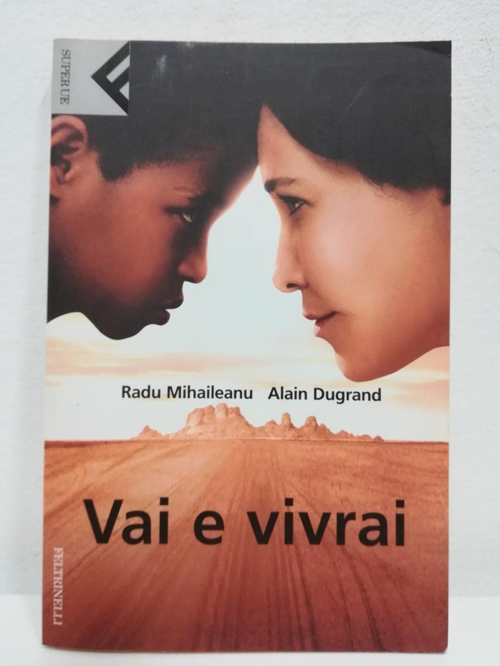
Vai e vivrai (Italian Edition)... |
|
|---|---|---|---|---|
| Price | $8.07 | $12.88 | $12.45 | $12.11 |
| Brand | Bill Bryson | Marvett Publishing | Emma Otheguy | Radu Mihaileanu |
| Merchant | Amazon | Amazon | Amazon | Amazon |
| Availability | In Stock | In Stock | In Stock Scarce | In Stock |