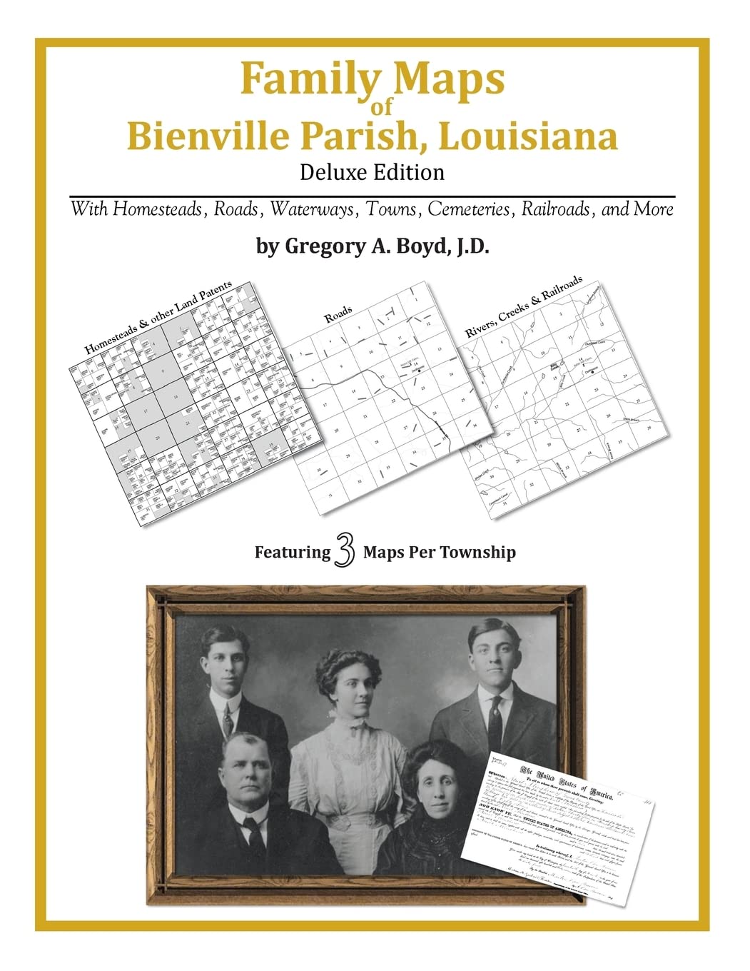
Family Maps of Bienville Parish, Louisiana
$34.95
| Brand | Gregory A. Boyd J.D |
| Merchant | Amazon |
| Category | Books |
| Availability | In Stock |
| SKU | 1420313274 |
| Age Group | ADULT |
| Condition | NEW |
| Gender | UNISEX |
| Google Product Category | Media > Books |
| Product Type | Books > Subjects > Reference > Atlases & Maps > Atlases & Gazetteers |
About this item
Family Maps of Bienville Parish, Louisiana
330 pages with 89 total maps Locating original landowners in maps has never been an easy task-until now. This volume in the Family Maps series contains newly created maps of original landowners (patent maps) in what is now Bienville Parish, Louisiana, gleaned from the indexes of the U.S. Bureau of Land Management. But it offers much more than that. For each township in the county, there are two additional maps accompanying the patent map: a road map and a map showing waterways, railroads, and both modern and many historical city-centers and cemeteries. Included are indexes to help you locate what you are looking for, whether you know a person's name, a last name, a place-name, or a cemetery. The combination of maps and indexes are designed to aid researchers of American history or genealogy to explore frontier neighborhoods, examine family migrations, locate hard-to-find cemeteries and towns, as well as locate land based on legal descriptions found in old documents or deeds. The patent-maps are essentially plat maps but instead of depicting owners for a particular year, these maps show original landowners, no matter when the transfer from the federal government was completed. Dates of patents typically begin near the time of statehood and run into the early 1900s. What's Mapped in this book (that you'll not likely find elsewhere) . . . 4960 Parcels of Land (with original landowner names and patent-dates labeled in the relevant map) 32 Cemeteries plus . . . Roads, and existing Rivers, Creeks, Streams, Railroads, and Small-towns (including some historical), etc. What YEARS are these maps for? Here are the counts for parcels of land mapped, by the decade in which the corresponding land patents were issued: Decade Parcel-count 1820s 3 1830s 444 1840s 207 1850s 1855 1860s 963 1870s 52 1880s 159 1890s 545 1900s 581 1910s 133 1920s 18 What Cities and Towns are in Bienville Parish, Louisiana (and in this book)? Ada, Alberta, Anderson, Arcadia, Armistead, Bear Creek, Bienville, Blume, Brown, Bryan (historical), Bryceland, Burkplace, Carolina, Castor, Cox Crossing, Crowson, Danville, Driscoll (historical), Ebenezer, English, Fords, Friendship, Fryeburg, Gibsland, Guynes, Hunt (historical), Jamestown, Lawhon, Liberty Hill, Loe, Lucky, Manning (historical), Mount Lebanon, Mount Olive, New Friendship, New Ramah, Newman (historical), Old Castor, Old Saline, Phillips, Pine Grove, Pleasant Hill, Pratt, Ridge, Ringgold, Roy, Sailes, Saline, Shady, Sparta, Taylor, Thomas (historical), Tullis, Walsh, Woodardville
| Brand | Gregory A. Boyd J.D |
| Merchant | Amazon |
| Category | Books |
| Availability | In Stock |
| SKU | 1420313274 |
| Age Group | ADULT |
| Condition | NEW |
| Gender | UNISEX |
| Google Product Category | Media > Books |
| Product Type | Books > Subjects > Reference > Atlases & Maps > Atlases & Gazetteers |


Compare with similar items

Why Comrades go to War: Liberation Polit... |
Vintage Nautical And Island Maps Scrapbo... |

3500 Gujarati to English Transalation Se... |

My Best Friend... |
|
|---|---|---|---|---|
| Price | $27.50 | $11.99 | $22.00 | $5.99 |
| Brand | Philip Roessler | Olga Romano | Devbrat Rudra | Mary Ann Rodman |
| Merchant | Amazon | Amazon | Amazon | Amazon |
| Availability | In Stock Scarce | In Stock | In Stock | In Stock Scarce |